


CartoDruid GIS offline tool
Descrizione di CartoDruid GIS offline tool
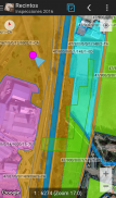
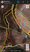
CartoDruid è un'applicazione GIS sviluppata dall'Instituto Tecnológico Agrario de Castilla y León (ITACyL), progettata come strumento di supporto al lavoro sul campo. Affronta la sfida della modifica offline di informazioni georeferenziate.
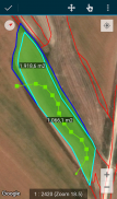
In molte aree di campo con copertura mobile insufficiente, CartoDruid fornisce una soluzione affidabile consentendo la visualizzazione di strati raster e vettoriali memorizzati sul dispositivo. Permette la creazione di nuove geometrie (entità) disegnandole direttamente sullo schermo o utilizzando GPS incorporato o esterno.
CartoDruid è facile da usare e non richiede conoscenze GIS precedenti, rendendolo facile da configurare e utilizzare per chiunque gestisca informazioni sul lavoro sul campo. I dati generati possono essere esportati per l'utilizzo in applicazioni esterne.
Le caratteristiche di CartoDruid includono:
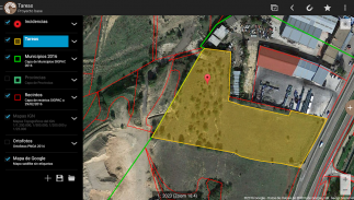
Visualizzazione di Google Maps online.
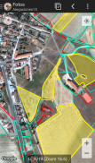
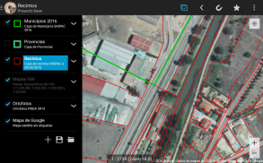
Utilizzo della cartografia vettoriale in un database SpatiaLite.
Supporto per immagini raster da un database RasterLite.
Consumo dei servizi WMS online.
Creazione e configurazione di nuovi layer sul dispositivo.
Filtraggio, simbologie, etichettatura, ricerca e moduli di identificazione basati su query SQL.
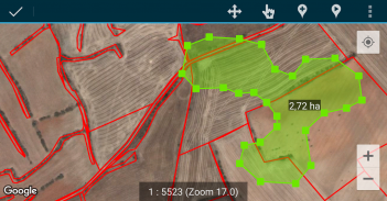
Modifica degli attributi e disegno manuale delle geometrie.
Disegno e modifica di geometrie basati su GPS.
Strumenti avanzati di modifica della geometria.
Funzionalità di salvataggio dei dati, inclusi dati georeferenziati e associazione di immagini a entità.
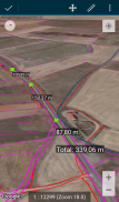
Strumenti aggiuntivi come ricerca SIGPAC, strumenti di misurazione, aiuti alla navigazione, gestione dei segnalibri.
Funzionalità di importazione ed esportazione in più formati.
Gestione TOC e supporto file SHP come funzionalità sperimentale.
Controlli operativi sui livelli.
CartoDruid utilizza servizi di localizzazione in background per creare funzionalità basate sul rilevamento della posizione. La posizione dell'utente viene utilizzata solo per creare vertici geometrici o posizionamento sulla mappa, con i dati archiviati localmente e non inviati all'esterno del dispositivo. L'eliminazione della cartella di progetto consente una facile rimozione dei dati.
Per un elenco completo di funzionalità, esempi scaricabili e guide iniziali, visitare www.cartodruid.es.
CartoDruid GIS offline tool - Versione 0.63.2
(29-05-2025)CartoDruid GIS offline tool - Informazioni APK
Versione APK: 0.63.2Pacchetto: es.jcyl.ita.crtdrdUltima versione di CartoDruid GIS offline tool
Altre versioni


App nella stessa categoria


Potrebbe piacerti anche...


